
Built for a fringe event at the State of the Map conference: find the best hiking weather within a chosen radius, then good hikes near that weather, and deliver the answer, all in a format teachable to an audience who already knew OpenStreetMap inside out.
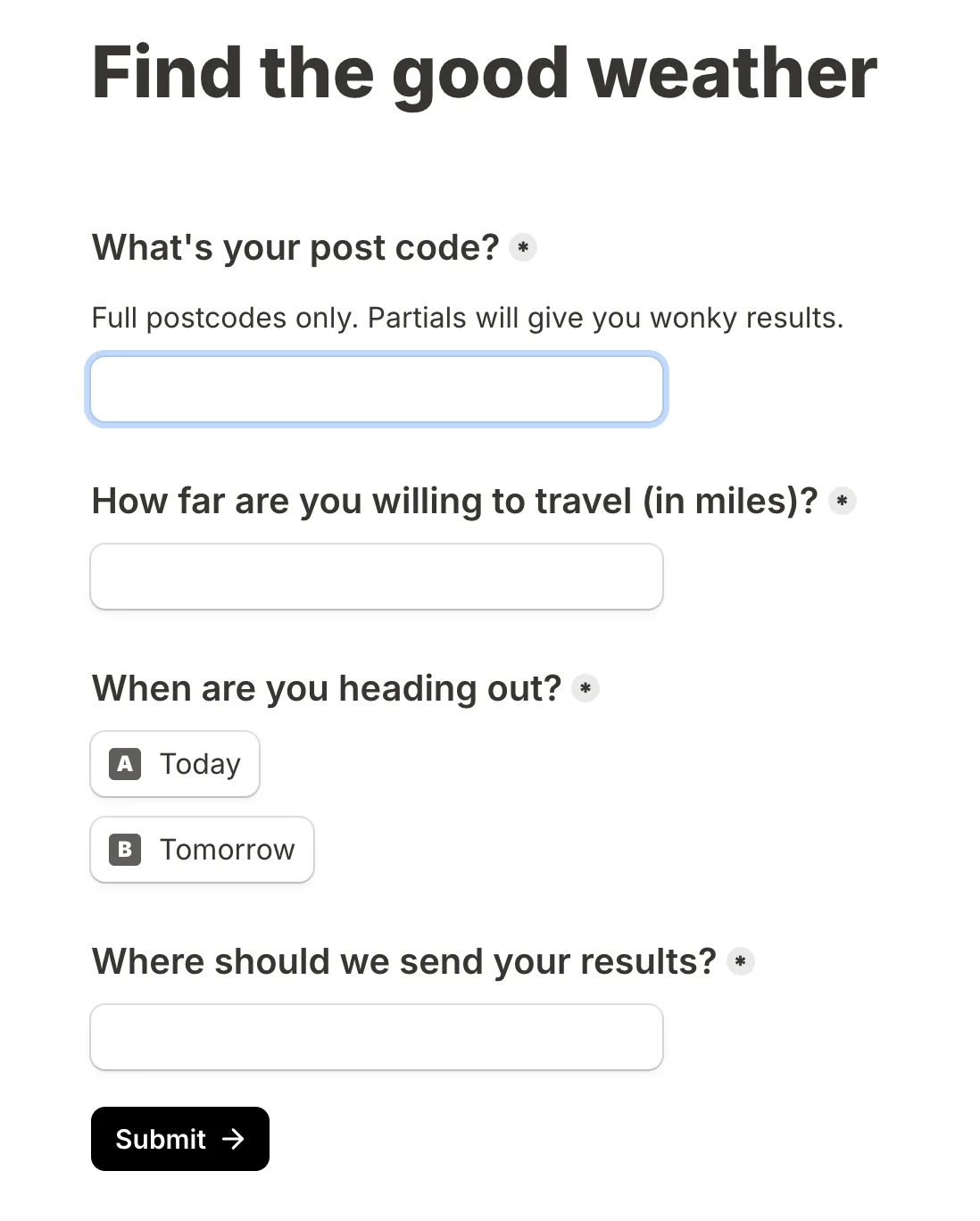
A user submits postcode, radius, preferred day and email through a Tally form. An n8n workflow geocodes the postcode, samples nine points in different directions, scores each location's weather with custom logic, picks the best, queries Overpass for nearby peaks and viewpoints, and emails the result.
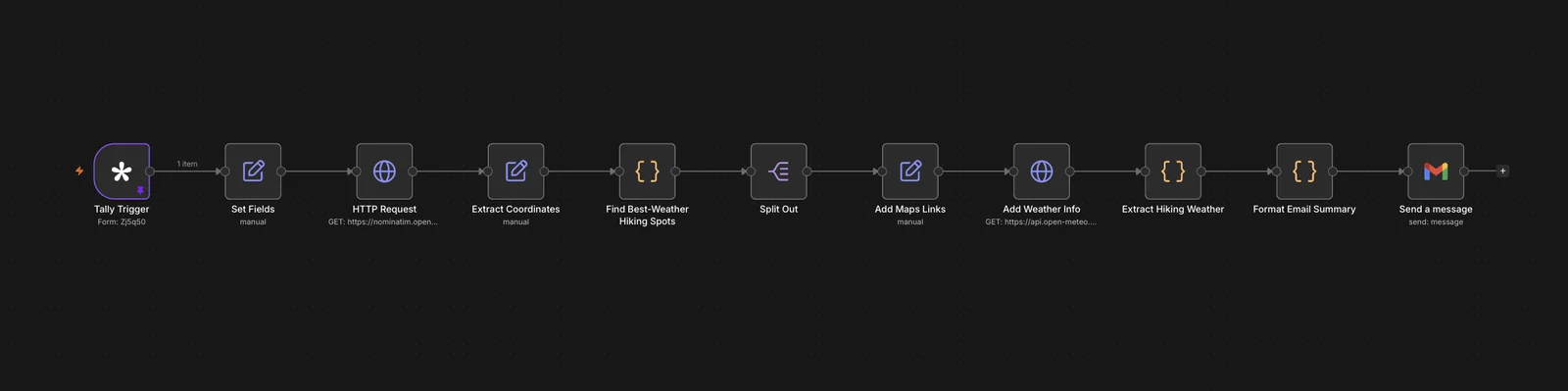
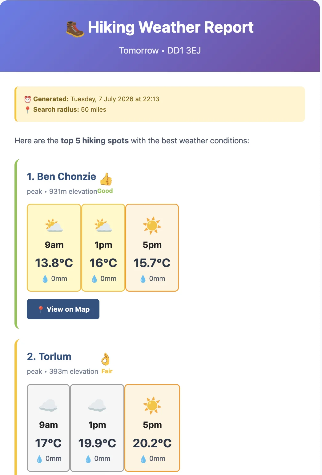
A working, taught-live demo that wove four APIs, custom scoring and real geographic maths into one orchestration.
Wrestling Overpass QL syntax and the miles-to-metres conversions taught me to keep queries lean. Capping the output kept it fast enough to demo without awkward pauses.
Try it live → Boyle the Builder